
Hydrogeological

-
EIS Sections: (i) soils and geology, (ii) hydrogeology
Tier 1/2/3 Hydrogeological Assessment
Soakaway design in accordance with BREDigest 365 infiltration tests
Discharge license applications (groundwater)
Source Protection Zone delineation
Site assessment for Integrated Constructed Wetland
Tank Integrity Assessment
-
Third party well surveys using RTK VRS
Groundwater contour mapping
Design and installation supervision of monitoring boreholes
Design and installation supervision of production boreholes
Trial pit logging in accordance with BS5930:1999.
Groundwater sampling
Pumping tests to determine sustainable yield
Falling head tests to determine subsoil and bedrock permeability
Long term groundwater level monitoring using dataloggers
Hydrological

-
EIS Section: Water
Discharge licence application (surface water)
Drainage impact assessments
Hydrochemical assessments
Surface water abstraction impact assessments
Low flow modelling
Quarry discharge impact assessments
-
Flow monitoring
Lake sampling using van dorm sampler and secchi disk
Cross-sectional river surveying using RTK VRS
tormwater management using various SuDS Stechniques
River sampling
Bathymetric surveying
Drainage design
Culvert capacity assessments
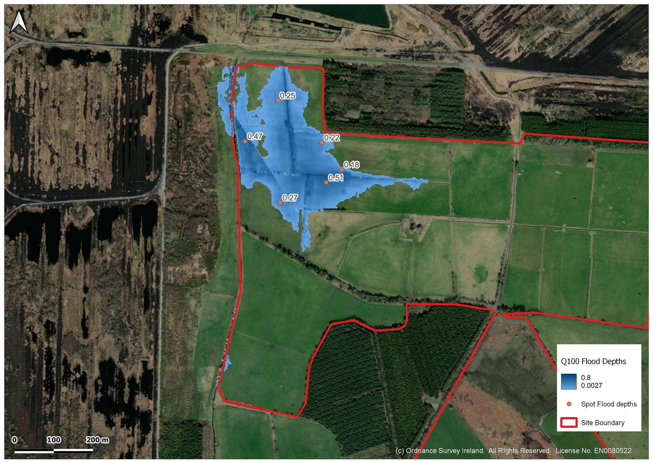
Flood Risk Assessment
-
Single house
Housing developments
Inert infill sites
Commercial facilities
Agricultural drainage
Quarry discharges
Stormwater attenuation discharges
Amenity facilities
-
Open channel surveying using RTK VRS
Manual cross-sectional profiling of deep channels
Sonar in combination with RTK VRS from kayak/boat to carry out bathymetric surveys of lakes/coastal areas
ISIS hydraulic modelling software is used to determine flood levels
Statistical analyses of historical hydrometric data
Flood estimation using catchment characteristics
Graphical cross-sectional profiles
Determination of freeboard to finished floor level