
PUBLIC WATER SUPPLY

Project: Zone of Contribution (ZOC) delineation for GWS groundwater sources
Client: Geological Survey of Ireland (GSI) / National Federation of Group Water Schemes (NFGWS)
Description: Envirologic have undertaken 15 such assessments to date, covering a range of deep and shallow boreholes and small and large diameter springs in a variety of geological settings. Recommendations were made at each source to improve groundwater protection. Findings were disseminated via a series of presentations to group water scheme operators and committees.

Project: Birr Water Supply Scheme Abstraction Order
Client: Offaly County Council
Description: Contracted to perform a hydrological impact assessment of increasing abstraction rates from the Camcor River to augment water supplies and meet drinking water demand from Birr. Concerns had been raised by local angling groups who feared water levels would become too low for the safe upstream passage of trout to breeding grounds. The assessment involved RTK surveying of 35 cross-sectional profiles which fed into an ISIS hydraulic model used to determine river water levels during extreme low flow events. Envirologic participated as expert witness at the An Bord Pleanála oral hearing.

Project: Lough Owel Water Quality Investigation for Proposed Extension to Raw Water Intake
Client: AECOM / Finbarr Gannon & Co.
Description: Contracted to complete a review of the susceptibility to raw water turbidity spikes at the current intake location at Portloman Water Treatment Plant. The brief was to establish the benefits, if any, of relocating the intake to deeper waters by extending the intake system further into Lough Owel, including the potential benefits of reduced algae concentrations at greater depth. The study involved seasonal sampling visits, with a number of samples taken at different distances from the shoreline, and at various depths along the water column. Samples were obtained using a van dorm sampler, with unstable parameters measured, along with secchi depth. Thermal stratification was also defined in detail.
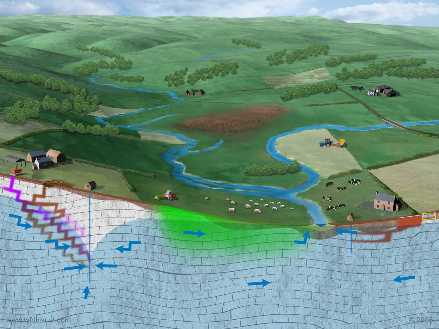
Project: Development of a catchment tool for estimating agricultural loadings of N and P to groundwater
Client: Environmental Protection Agency
Description: The tool is intended to compare potential nitrogen and phosphorus losses to groundwater from catchments in Ireland, and within these attempt to quantify the sources, pathways and losses to groundwater.
image source: Scotland & Northern Ireland Forum for Environmental Research (SNIFFER).
PRIVATE WATER SUPPLY

Project: Exploration and development of a commercial groundwater source for spring water bottling facility
Client: unnamed
Description: Exploration drilling for the development proved a high quality groundwater supply. Pumping test performed to quantify aquifer characteristics, delineate SPZ and assess potential impact on a nearby public supply scheme and local wells. Proposed design for production well.

Project: Tier 2 Hydrogeological Assessment
Client: Burren Distillers
Description: Supervised drilling and performed pumping test on a trial well for water supply to be used in the cooling of whiskey stills and attached visitor centre. Proposed new borehole design based on findings, with trial well to be used for re-injection of cooling water. Designed optimal wastewater treatment process and layout including discharge to ground in karst landscape.

Project: Discharge license application (groundwater)
Client: Boylan Engineering
Description: Hydrogeological assessment focussing on an on-site groundwater supply and percolation area to a nursing home. A pumping test was carried out to identify potential for connectivity between discharge area and drinking water source.
RESIDENTIAL

Project: Flood Risk Assessment
Client: Leonard Price Developments
Description: Proposed development consisting 100 dwellings. Envirologic compiled a detailed ISIS hydraulic model of a river using 15 cross sectional profiles surveyed using RTK VRS.

Project: Flood Risk Assessment
Client: Art McGann Architecture
Description: Proposed development consisting 26 dwellings. Envirologic compiled a detailed ISIS hydraulic model of a river using 15 cross sectional profiles surveyed using RTK VRS.

Project: Flood Risk Assessment
Client: Fore Enterprises
Description: Proposed development consisting 53 no. houses, creche, etc. Envirologic submitted a surface water management system incorporating SuDS methods plus a detailed assessment of the conveyance capacity of receiving waters.

Project: Flood Risk Assessment
Client: Milligan Reside Larkin Architects
Description: Residential development consisting 7 houses, Dublin. Flood defence wall and comprehensive SuDS measures implemented to mitigate risk of flooding to and from properties.

Project: Hydrogeological
Client: Casey O'Rourke Associates
Description: Envirologic supervised installation of a number of shallow wells to facilitate groundwater sampling (to identify source of groundwater) and pumping (to dewater a basement area). Site investigation works were carried out during construction phase on a nursing home in Dublin 4.
QUARRYING

Project: EIS Sections: Soils & Geology / Water
Client: Limestone quarry, Co. Galway
Description: Installation of 3 pumping test boreholes, 2 long term monitoring boreholes and 9 observation boreholes to assess potential increase in discharge resulting from deepening quarry by 30 metres.

Project: EIS Sections: Soils & Geology / Water
Client: Sand and gravel quarry, Co. Carlow.
Description: Combined assessment of existing 15 ha pit, and adjoining 19 ha greenfield area. Maximum flood level in the nearby river used to estimate maximum groundwater levels. These levels used to recommend a final pit floor level that will mitigate against risk of impact to groundwater quality. Surface water management plan to accommodate washing and screening of resource and settlement lagoons.

Project: Flood Risk Assessment
Client: Sand and gravel quarry, Co. Wexford
Description: Development of a hydraulic model to calculate maximum flood level in river adjoining pit. Mitigation measures included maintaining appropriate riparian margin within the flood zone.

Project: Surveying quarry discharge route
Client: Limestone quarry, Co. Roscommon.
Description: Developed a hydraulic model to measure conveyance capacity of a proposed surface water route for discharge of groundwater from a quarry. Clarified maximum allowable discharge rate and suitable receiving water body conditions.

Project: EIS Sections: Soils & Geology / Water
Client: Greywacke quarry, Co. Longford

Project: EIS Sections: Soils & Geology / Water
Client: Condron Concrete
Description: Assessment involved installation of 6 shallow groundwater monitoring boreholes. Mitigation measures proposed to protect nearby public water spring supply.

Project: EIS Sections: Soils & Geology / Water
Client: Sand and gravel quarry, Co. Cork.
Description: Project included assessment of ongoing reinstatement which has successfully restored previously excavated areas to diverse woodland.

Project: Flood Risk Assessment
Client: Sand and gravel quarry, Co. Meath
Description: Focus of study to quantify potential change to flood risk in the area that may arise from stripping soils, thereby altering infiltration rates at a greenfield site.
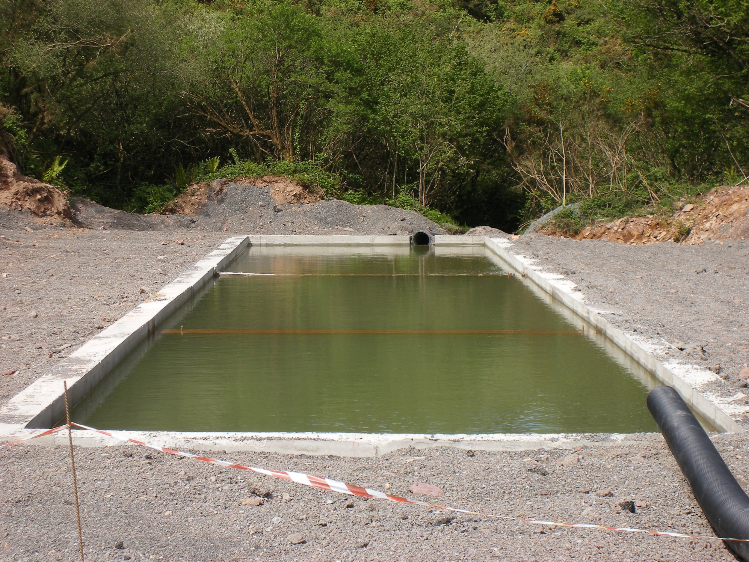
Project: Settlement Lagoon Design
Client: Limestone quarry, Co. Wicklow.
Description: Assisted in settlement lagoon design to treat discharge from a limestone quarry. Maintenance of settlement lagoons, particularly dredging, is important to ensure the design dimensions required for effective settling are maintained.
COMMERCIAL

Project: Generic Quantitative Risk Assessment as part of Due Diligence
Client: Service station
Description: Aim of project to assess integrity of underground fuel storage tanks. Groundwater quality assessed via four newly installed monitoring wells and existing production well; four trial pits excavated to facilitate soil sampling.

Project: Flood Risk Assessment
Client: Tullamore Medical Centre
Description: Envirologic were commissioned to undertake a site-specific flood risk assessment. Mitigation measures included a development-free zone between the main building and the Tullamore River, and specifications for widening of the river channel adjacent to the site.

Project: Flood Risk Assessment
Client: Digital Realty Trust / Doherty Finegan Kelly
Description: Provide specifications (channel dimensions, gradient, invert elevations) for proposed stream diversion, ensuring watercourse is capable of transmitting flood flows and does not increase flood risk to downgradient receptors. Contributions to assist the client in achieving excellent rating under BREEAM for data centre.

Project: Flood Risk Assessment
Client: Louisburgh Town Trust / Grady Carr Associates
Description: Demonstrated that development works at Derrylahan Inn do not increase flood risk to property or downgradient receptors.
AMENITY/EDUCATION

Project: Environmental Impact Assessment
Client: Canoeing Ireland
Description: High performance canoe slalom training and competition area on the River Liffey at Lucan. Envirologic undertook hydrological survey and commissioned ecologist and arboriculturist to complete assessment of environmental impacts. Envirologic assisted in producing the method statement.

Project: Tier 2 Hydrogeological Assessment
Client: PJ Newell Consulting Engineers / Department of Education & Skills
Description: Development consisting of a new school, effluent treatment system with disposal of treated effluent via a sand polishing filter with pressurised pipe network subsequently discharging to ground. Three monitoring boreholes were installed, with data gained from permeability tests and groundwater sampling used in attenuation calculations to assess suitability of site.
Cahergal National School; Lackagh National School; St Joseph's Secondary School, Spanish Point

Project: Hydrogeological Assessment
Client: Bord na Mona / Mount Lucas Wind Farm
Description: Extensive trial pitting to define subsoil conditions and establish the optimal siting of a zero discharge willow facility for treatment of domestic effluent from a service building and amenity centre.

Project: Flood Risk Assessment
Client: Inland Waterways Association of Ireland
Description: Determine minimum finished floor level to ensure development not at risk of flooding from Lough Ree.

Project: Flood Risk Assessment
Client: Chinese Gospel Church of Dublin / Doherty Finegan Kelly
Description: Determine minimum finished floor level of new buildings. Provide specifications for flood defences suitable for an existing building with protected status.
AGRICULTURE

Project: Integrated Constructed Wetland (ICW)
Client: FH Wetland Systems
Description: Assessment of soil, subsoil and groundwater characteristics to facilitate the design of an ICW to store and treat farmyard runoff from a large dairy unit.
Project: Hydrological Assessment
Client: Lakeland Dairies
Description: Stream realignment to facilitate dairy processing facility site layout revisions. Restoration works included optimisation of in-stream morphology.

Project: Hydrogeological Assessment
Client: Boylan Engineering
Description: Tank integrity testing at an intensive pig-rearing facility, Co. Cavan. Compiled taking cognisance of Specific Requirements for Intensive Agriculture - Template groundwater monitoring proposal for the detection of any possible leakages: contamination at intensive agriculture installations.
Involved installation of 3 groundwater monitoring boreholes for subsoil and bedrock permeability testing and groundwater quality monitoring.

Project: Flood Risk Assessment
Client: Gurteen Agricultural College
Description: Surface water management and drainage design and specifications to alleviate road flooding and facilitate a new dairy and learning centre.
Project: Stormwater Management
Client: Ballycarny Grain / Ennis Martin Architecture
Description: Development consisting grain driers, grain storage bins, agricultural sheds for the purpose of storing and drying grain, agricultural store and large yard areas. Infiltration rates from soakaway tests performed in accordance with BRE Digest 365 used to design infiltration trenches.
WASTE MANAGEMENT

Project: Tier 1/2 Hydrogeological Investigations
Client: Cavan County Council
Description: Technical assessments at four historic unlined landfills, in accordance with the Guidance on the Authorisation of Discharges to Groundwater, published by the Environmental Protection Agency.
Included initial conceptual site models and recommendation of groundwater compliance points and values. Next phase of works to include installation of additional monitoring boreholes.

Project: Tier 1/2/3 Unregulated landfill risk assessment
Description: Site investigation works involved excavation of 17 trial pits and installation of 6 groundwater monitoring wells, 1 leachate monitoring well and 3 landfill gas monitoring wells.

Project: EIS Sections: (i) Soils & Geology, (ii) Water
Client: Wilton Waste Recycling / Boylan Engineering
Description: Development of a brownfield site for composting activities involving change of a feedstock, consisting of sludge and listed amendment material, into stabilised biosolids for agricultural use.

Project: Hydrogeological Investigation
Client: Enrich Environmental
Description: Development of a site for the production of renewable energy and soil improvers. The facility will consist of reception shed, sealed chambers, drying rooms, blending shed, biofilter, storage tanks, CHP unit and ESB substation.
Envirologic performed a pumping test of on-site groundwater well to define zone of contribution. A groundwater source protection plan recommended alterations to the headworks arrangement. Stormwater attenuation and discharge route specifications also included.

Project: Fire Water Risk Assessment
Client: O'Toole Composting / Enviroguide
Description: Composting and waste recycling facility. Full water usage audit and mitigation measures to ensure all firewater runoff is contained during a high intensity rainfall event.
DRAINAGE

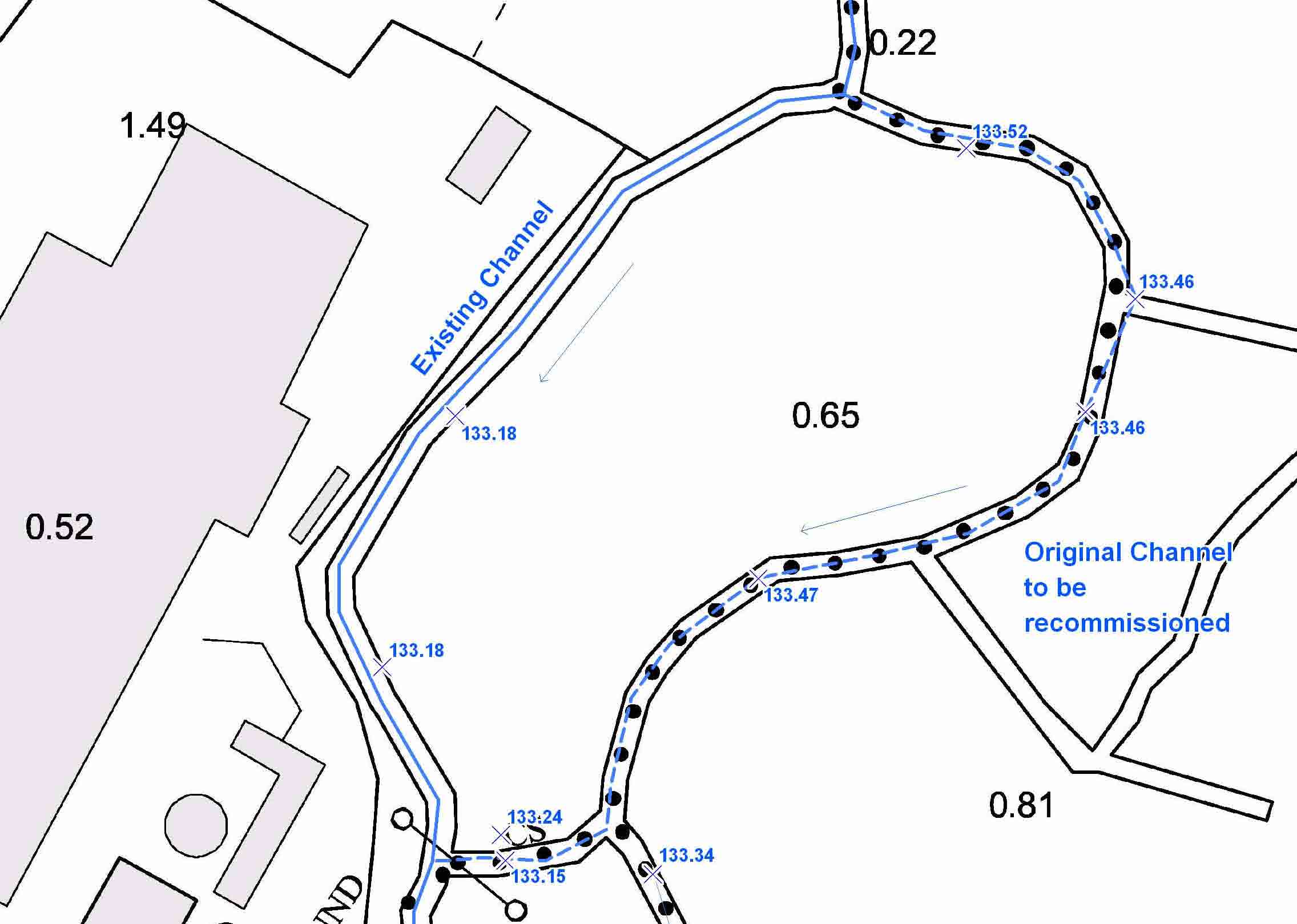
Project: Assessment of impacts from proposed drainage maintenance works on a 5.3 km stretch of the Ballynamanagh River and tributaries within Oranhill Drainage District.
Client: Galway County Council
Description: Remediation works to a previous drainage scheme were necessary to prevent road flooding and to mitigate the risk of flooding to local houses and lands. The Department of Arts, Heritage and the Gaeltacht requested an assessment of potential impacts to Creganna Marsh SPA and local turloughs. Envirologic Ltd. surveyed 30 cross sections and developed a hydraulic model using ISIS. This was validated using observed water levels and used to model pre- and post-remediation water levels under flood conditions.

Project: Hydrological impact assessment due to culvert reinstatement works
Client: Galway County Council / Moore Group
Description: The Department of Arts, Heritage and the Gaeltacht requested an assessment of potential impacts to water quality and hydrological regime at East Burren Complex SAC and Coole Garryland Complex SAC that may arise following the upgrading of an old stone culvert with a concrete twin-box arrangement.